2017 study pinpoints high-risk sinkhole zones in KL
The six areas categorised as 'high' and 'very high' risk were Pudu, Cheras, Kepong, Kampung Baru, Ampang, and Pandan Jaya.


SHAH ALAM - Geological experts have warned that there are six locations around Kuala Lumpur that are at a higher risk of experiencing sinkhole phenomena compared to the recent incident at Jalan Masjid India.
The six areas categorised as 'high' and 'very high' risk were Pudu, Cheras, Kepong, Kampung Baru, Ampang, and Pandan Jaya.
Areas with moderate, low, and very low risk included Taman Tun Dr Ismail (TTDI), Brickfields, Bukit Jalil and Sungai Besi.
These findings were based on a 2017 study titled ‘Sinkhole Susceptibility Hazard Zones Using Geographic Information System (GIS) and Analytic Hierarchy Process (AHP): A Case Study of Kuala Lumpur and Ampang Jaya.’

The study was conducted by Mohd Asri Hakim Mohd Rosdi, Ainon Nisa Othman, Muhamad Arief Muhd Zubir, Zulkiflee Abdul Latif and Zaharah Mohd Yusoff from the School of Surveying and Geomatics, Faculty of Architecture, Planning, and Surveying, Universiti Teknologi Mara (UiTM) Shah Alam.
One of the researchers, now a senior lecturer in Geomatics and Natural Resources Science at UiTM Shah Alam Dr Ainon Nisa Othman said that the study was conducted entirely using GIS methods combined with AHP techniques based on the available geospatial data at that time.
"Referring to the study conducted in 2017, 76 per cent of the areas in KL and Ampang Jaya showed a high and very high hazard risk for sinkholes.
"However, with the changing climate and unpredictable global weather, the listed areas may experience changes.
"At present, there has been no continuity in studies involving sinkholes in the Kuala Lumpur and Ampang areas," she told Sinar Premium.
Ainon explained that five criteria were used to determine the sinkhole hazard risk in an area.
“The criterias are type of soil, lithology, land use, groundwater level, location of groundwater wells.
"Generally, the geological structure of an area remains constant. However, consulting geological experts is recommended," she added.
Ainon also revealed six physical factors contributing to the occurrence of sinkholes in KL and Ampang Jaya.
“The physical factors causing sinkholes are due to changes in topography and geomorphology resulting from widespread development and land use planning, rapid development on former mining land, traffic congestion and changes in groundwater.
“In addition, rapid development and industrial activities, as well as the city's location on limestone areas according to sources from past studies, also contribute to the occurrence of sinkholes,” she explained."
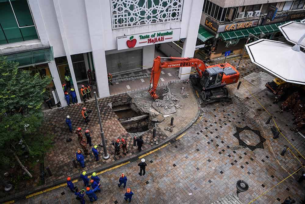
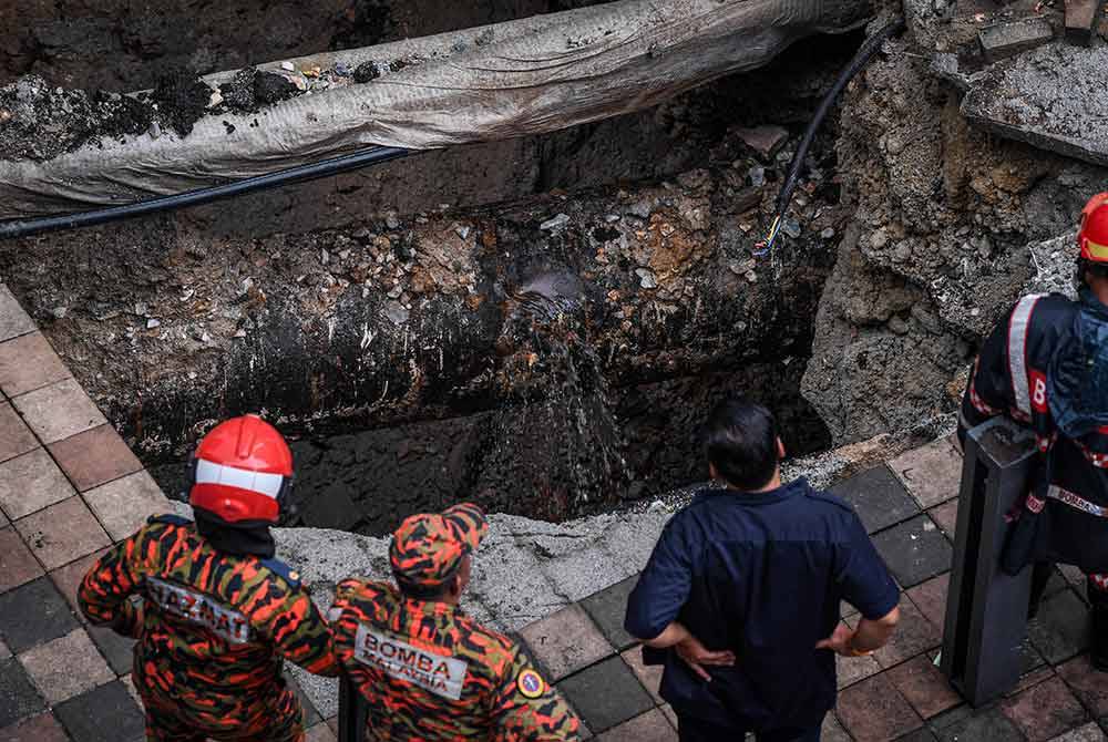
On Aug 23, an Indian tourist, Vijayaletchumy, 48, fell into an eight-meter-deep sinkhole at Jalan Masjid India.
Despite extensive search efforts, the tourist remains missing after six days.
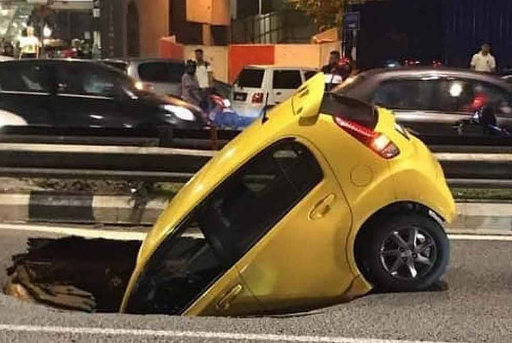
Previously, the Malaysian Society for Engineering Geology and Rock Mechanics president, Dr Goh Thian Lai, said that nearly 40 per cent of KL's underground was covered by limestone, making it susceptible to geological disasters like sinkholes if authorities did not act promptly.
Goh noted that most sinkhole incidents around the capital were caused by human activities, such as burst pipes and tunnelling, in addition to natural factors.
The Masjid India Incident Raises Concerns
Another researcher Mohd Asri Hakim Mohd Rosdi, currently a geospatial officer at Kuantan City Council, Pahang, expressed concerns over the incident at Masjid India, as there were no warning signs before the sinkhole occurred.
"This situation is very worrying because the sinkhole happened suddenly, causing the victim to fall into the area. This is quite different from other disasters, such as landslides, which usually show clear signs before occurring.
"Disasters can happen anywhere and at any time. If an area frequently experiences sinkhole incidents, it indicates a need for attention, monitoring, and careful planning, especially in disaster management," he said.
He added that similar incidents could recur, particularly with heavy rainfall and high-water infiltration in the area.
"Therefore, property owners, residents, and the public need to play a role in understanding and managing areas prone to sinkholes.
"Everyone is advised to stay alert and observe their surroundings for signs like building structural failures, water flow, and land movement, which may occur due to heavy rain," he explained.
Asri also suggested that any development in high-risk areas should obtain an Environmental Impact Assessment (EIA) to reduce the likelihood of disasters.
"Additionally, consultation with geological experts is recommended if signs are contributing to sinkholes.
"Underground utility mapping should also be implemented for future development using geospatial analysis to reduce surface risks. The use of the latest technology, such as Ground Penetrating Radar (GPR), to assess underground utility conditions, will help better identify potential sinkhole areas early on," he added.


